

NGA
- North America
- Central, South America
- Western Africa, Mediterranean, Black Sea
- Eastern Africa, Southern Asia
- Australia, New Zealand, Indonesia, Papua New Guinea
- South Pacific Islands
- Eastern Asia, South Eastern Russia, Philippines
- Other Regions
Canadian
Caribbean and Mediterranean
Norwegian
SHOM
SEMAR
U.S.
Search by chart title, key word or chart number:
NHS Print-on-Demand Charts for Norwegian Coast
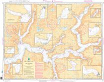 Covering the Norwegian Coast
Norwegian Hydrographic Service charts provide commercial and recreational mariners with navigational information for the Norwegian coast, including polar waters. OceanGrafix charts serve as a valuable complement to electronic systems — and critical back up when the unexpected happens.
NHS Print-on-Demand Charts are available here:
I need a chart for U.S. waters

©2026 Nautical Charts Online, All Rights Reserved.