

NGA
- North America
- Central, South America
- Western Africa, Mediterranean, Black Sea
- Eastern Africa, Southern Asia
- Australia, New Zealand, Indonesia, Papua New Guinea
- South Pacific Islands
- Eastern Asia, South Eastern Russia, Philippines
- Other Regions
Canadian
Caribbean and Mediterranean
Norwegian
SHOM
SEMAR
U.S.
Search by chart title, key word or chart number:
CHS Charts for Canadian Waters
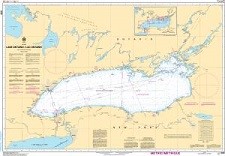 Navigate Canada’s coastline and major inland waterways
Canadian Hydrographic Service (CHS) charts provide commercial and recreational mariners with navigational information for Canadian waters. That’s a big job, since Canada has the longest coastline in the world! We continuously incorporate CHS’ latest cartographic changes into every chart — guaranteeing that our customers are getting the most accurate and up to date information available!
CHS Print-on-Demand Charts are available for the following areas:
I need a chart for U.S. waters

©2026 Nautical Charts Online, All Rights Reserved.